Hall of Images
Soviet labour camp maps
| File Upload | Title | Description | Related military service | Related Museum Gallery | Related Wall of Tribute Links |
|---|---|---|---|---|---|
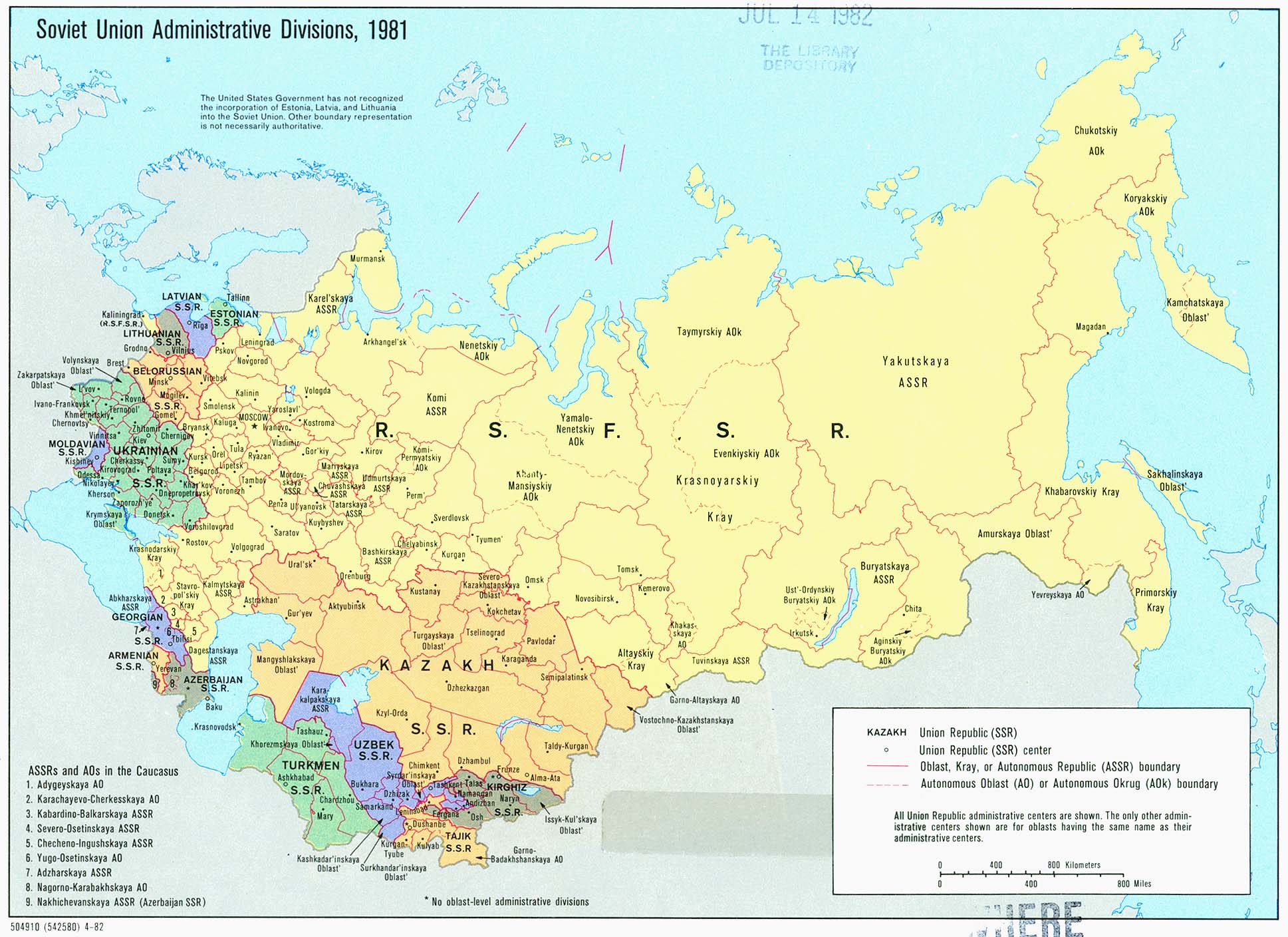 |
soviet_union_admin_1981 |
Soviet Union admin 1981. Perry-CastaĂąeda Library Map Collection, University of Texas Libraries |
|||
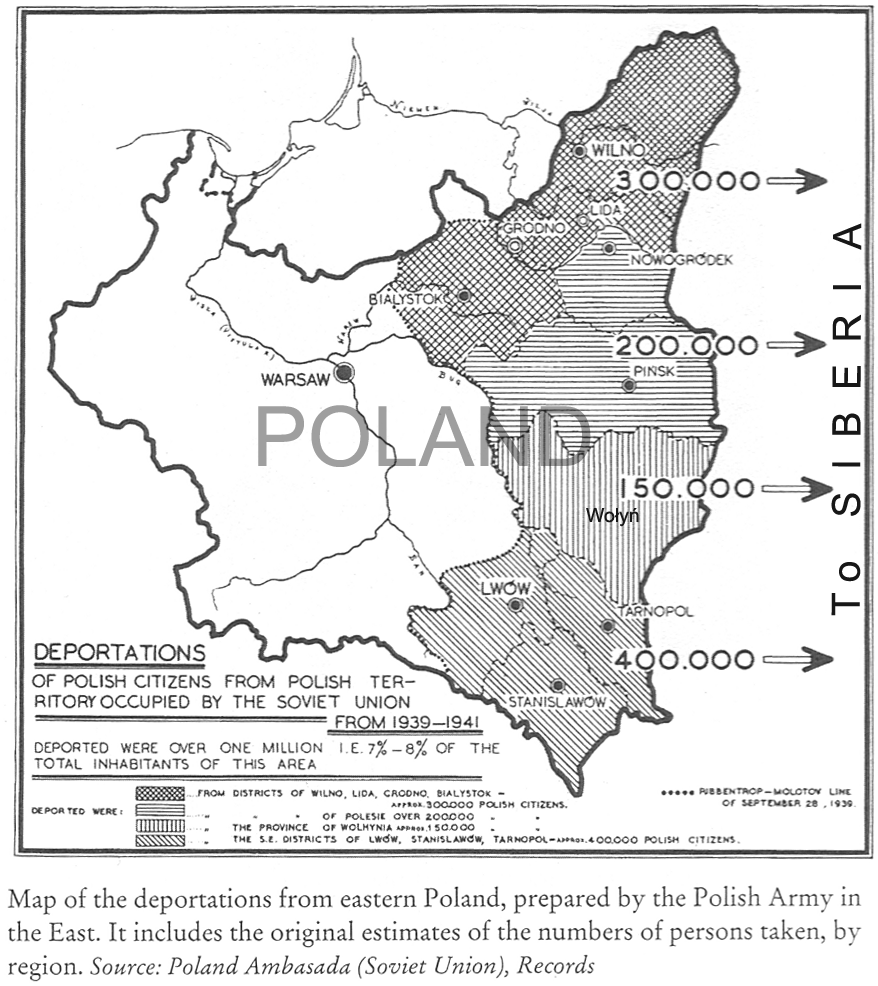 |
Polish_Deportat_a_1939_1941 |
Deportation of Polish citizens. Scanned by Zbyszek Styrna from the book "Exile & Identity", Polish Women in the Soviet Union during WWII, by Katherine R. Jolluck |
|||
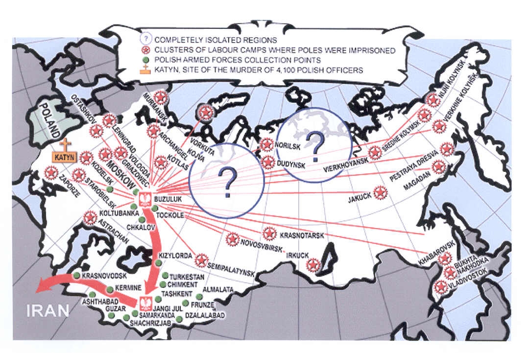 |
Labour_Camps_and_Polish_Armed_Forces_collection_points_in_USSR_1942 |
Labour Camps and Polish Armed Forces collection points in USSR 1942. Source: "The Fate of the Poles in he USSR 1939-1989" by Tomasz Piesakowski. This map is based on the research of General Wladyslaw Anders, who led nearly 120,000 of the deported Poles out of the Soviet Union. |
|||
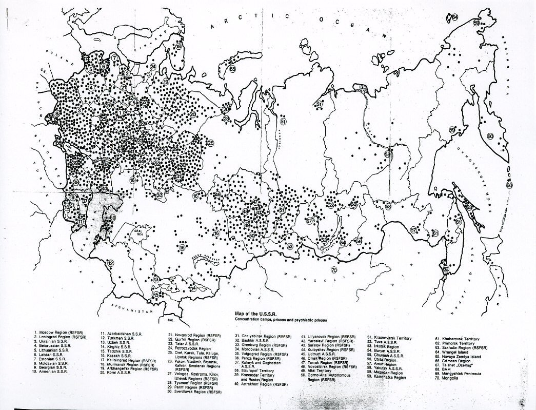 |
Gulags_in_Russia |
Gulags in Russia. Scanned by Julian Plowy from: "The First Guidebook To Prisons and Concentration Camps of the Soviet Union" Author Avraham Shifrin This book has 391 pages this map plus about 170 other maps of individual prison sites. It contains detail information on 2000 penal/slave camps/concentration camps, some photos and some camp layout drawings. It is a great book to acquire. |
|||
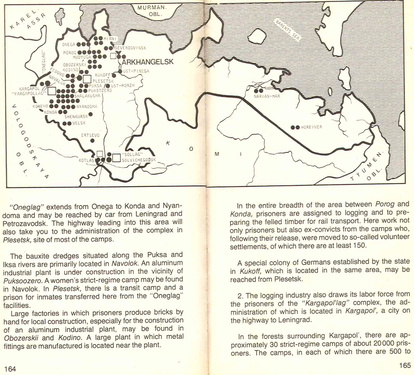 |
Arkhangelsk_Gulags |
Arkhangelsk Gulags, from "The first Guide Book to Prisons and Concentration Camps of the Soviet Union" By Avraham Shifrin, Bantam Books inc. 1982. Posted by Zbigniew Bob Styrna |
|||
 |
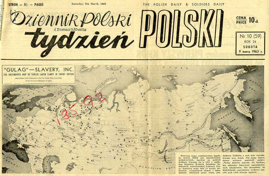
GULAG_Slavery_Inc_map_001 |
GULAG-Slavery Inc. map, 1951. Courtesy of The George Meany Memorial Archives (Silver Spring MD 20903 USA). Part of a submission to the US Congress on Soviet Forced Labor camps by the Free Trade Committee of the American Federation of Labor. |
|||
 |
polskimap_paper_Gulag_466FF |
Scanned by Zbigniew Bob Styrna |
|||
 |
cyrillic_alphabet |
cyrillic-alphabet |
|||
 |
Louise Blazejowska’s Deportation map-2 |
Louise's grandmother's map 2. Submitted by Louise Blazejowska. These maps are part of a large map of central Russia - war period issue - showing mainly a section of Trans-Siberian rail line from Moscow via Samara to Krasnoyarsk with a link from Archangielsk via Vologda, Vietka and Perm escaping the Ural Mountains. Perm to Krasnoyarsk section has practically all major stations marked up and named. |
|||
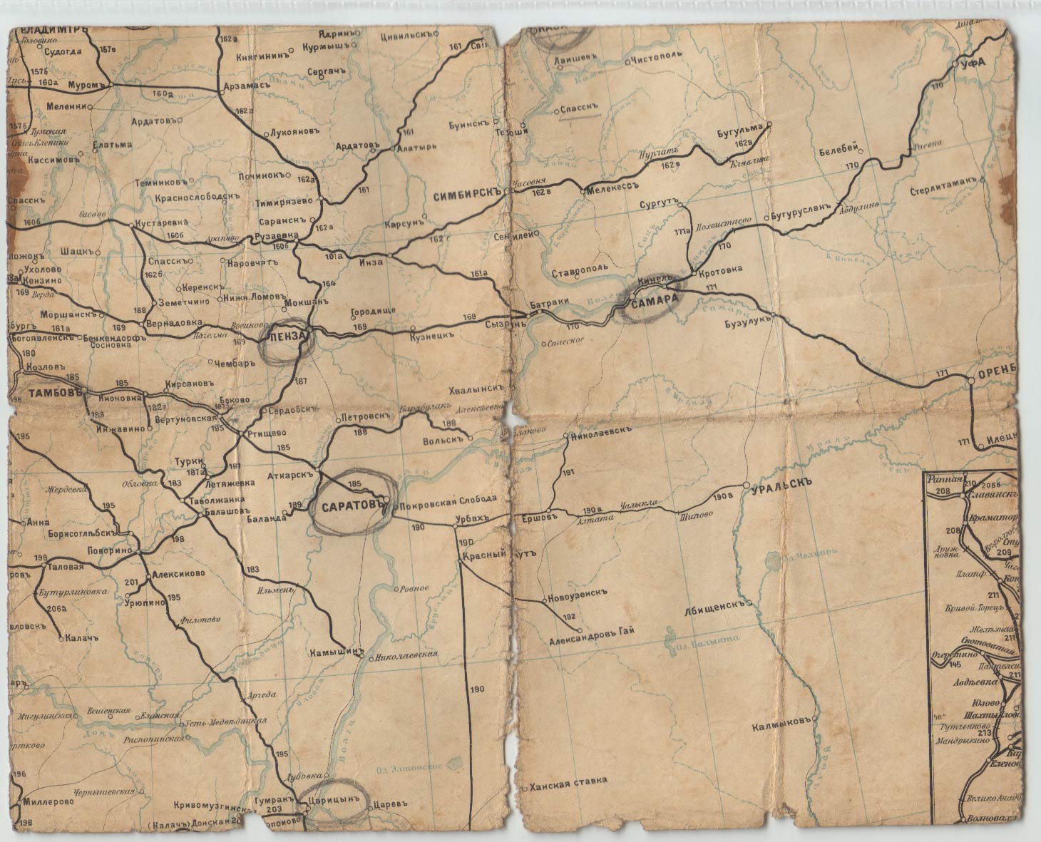 |
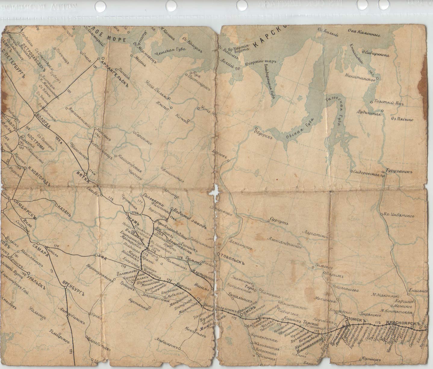
Louise Blazejowska’s Deportation map-1 |
Louise's grandmother's map 1. Submitted by Louise Blazejowska. This part of the map is of Cental/Southern Russia from Tambor to Penza to Samara and Uralsk. This section includes very important places for us; namely Buzuluk and Tockoye by Samara (Kuybishev) where Gen. Anders started to form the Polish Forces. The circles are around Penza, Samara, Saratov and Carycyn. Saratov was linked up to Tatishchevo where a Polish hospital was established and again it was a major joining point for Poles entering the Army. I believe that Penza and Carycyn are incidental line-changing places. The names of places on the maps are of old style and many have been changed on modern maps. The place names are useful to us as many people have some kind of documents marked in that style. These maps cover the area of Russia and not the present day Kazachstan (noted by Antoni Kazimierski) |
|||
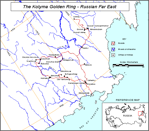 |
Kolyma |
Kolyma |
|||
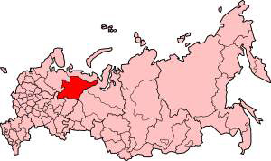 |
Russia_Komi |
Russia-Komi |
|||
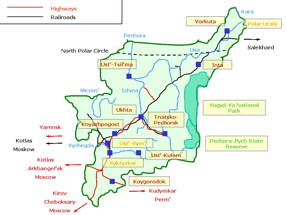 |
Komi |
Komi |
|||
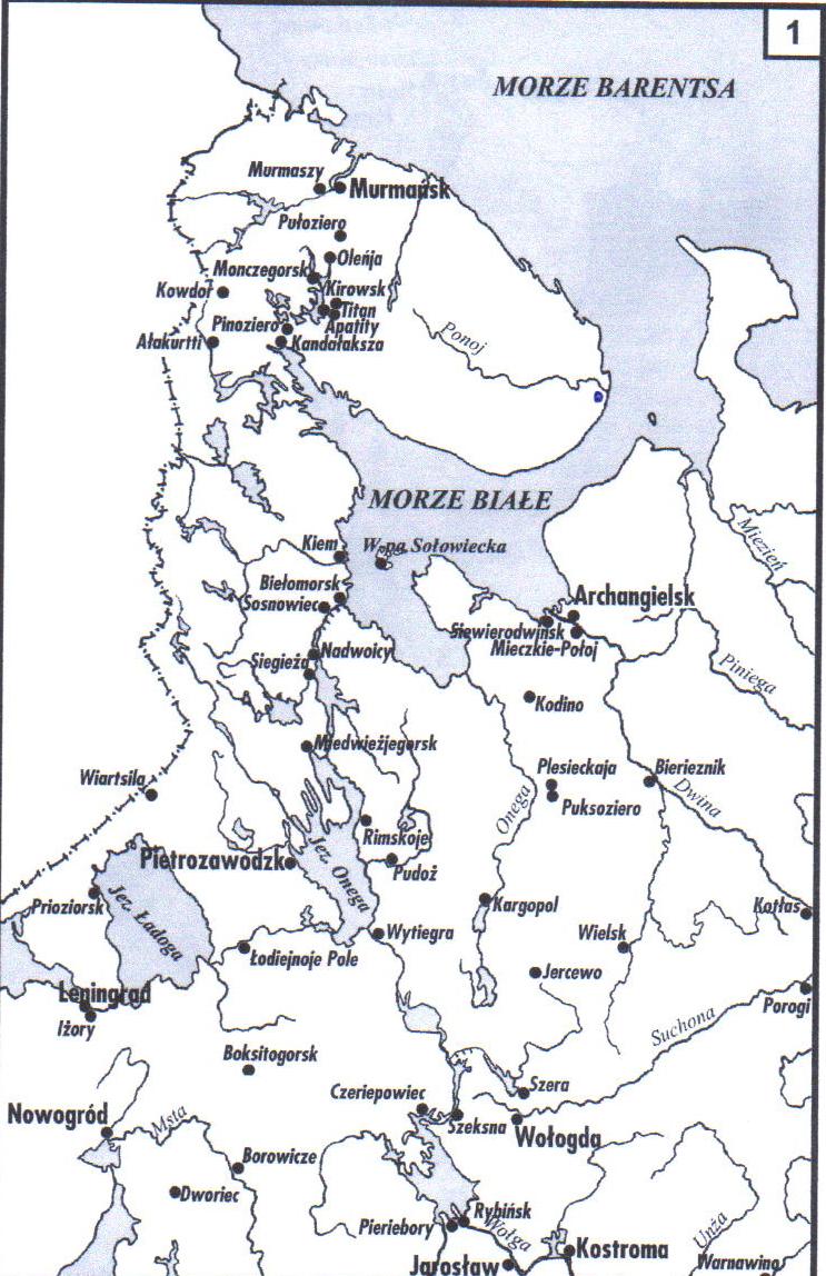 |
camps in Murmansk area |
This map is from a book called 'LAGRY Przewodnik Encyklopedyczny' prepared in collaboration by Karta and Stowarzyszenie 'Memorial' in Moscow. Warsaw 1998. Translated from Russian. Submitted by Antoni Kazimierski. |